Wimereux: the Slack dunes
Although the fine sand is like that on Wimereux Beach, the flora and fauna found there are quite different.
- 4mn read

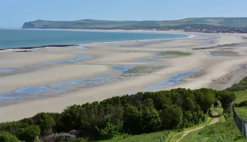
Not far from the Nausicaá aquarium and a short distance from Wimereux - a lovely seaside resort on the Opal Coast, in the Hauts-de-France region - stretch out the Slack dunes, on the Deux Caps site, a Grand Site de France listed site. Although the fine sand is like that on Wimereux Beach, the flora and fauna found there are quite different. There are no rubber rings, sand castles or parasols here.
The Slack Dunes in Wimereux, an exceptional natural site
The site is classified as a special conservation area by the National Cultural Heritage Inventory. Salt pannes and pools, a pine forest and a beach cohabit in perfect harmony.
The dunes owe their name to the Slack, a 22-kilometre long coastal river. The Slack dunes are fragile. Like all dunes, they were formed by the accumulation of grains of sand pushed here by the wind. This also explains why the dune moves, depending on which way the wind is blowing. But the dunes do not only consist of grains of sand: they are also home to mosses, lichens, trees, so many plants that play a fundamental role in the stabilisation of the dune because their roots hold the sand in place.
This is why you must pay a great deal of attention to the plants growing on the dunes: you must take care not to crush them when you walk on the dunes, as that would weaken the dunes.
The Slack loop, a nature walk for all the family
The Slack loop path leaves from the car park on the way out of Ambleteuse, heading towards Wimereux, on the right after the bridge crossing the little coastal river. The path takes you to Fort Ambleteuse, whose massive architecture you'll be able to admire. Once you've arrived on the beach, walk along the shore to the left. After 800 metres, you'll find a path that goes up to the Slack dunes.
At the top, a magnificent panorama stretches out over the town of Boulogne-sur-Mer and the Pointe aux Oies. Follow the path to the car park, then cross the road and go to the path that leads to the observatory. From there, you'll be able to admire the beauty of the dunescape. The dunes soon give way to a pine forest then to a path going through a wetland, where there are observatories allowing you to watch the fauna.
The pools that you can see on the surface of the dunes are in fact outcrops of the water table. The amphibeans come to breed every year in this fresh water, called "dune pools": frogs, toads, salamanders, etc. You'll also be able to see dragonflies with shimmering colours: turquoise, ruby red, emerald green… Then take the stairs that go under the road, to go back to your departure point.
The Pointe aux Oies path
From Wimereux Beach, you can also go to Pointe aux Oies on foot, taking a stretch of the coastal path that has recently been improved. The path departs from the Wimereux seawall promenade, heading northwards. It takes you via the Pointe de la Rochette, whose dog-head shaped silhouette in fact hides a German bunker built during the Second World War.
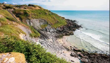
This blockhaus is one of the many vestiges of the Atlantic Wall that Hitler wanted to erect to prevent an allied landing. The path continues, still heading north, to the Pointe aux Oies. From there, you can admire Ambleteuse, and notably its fort to the north, and to the south the Carnot de Boulogne seawall. On the foreshore you can see traces of the forest that occupied this site more than 12,000 years ago.


